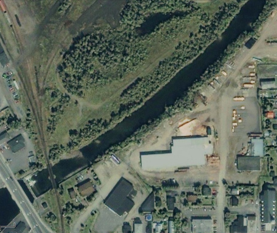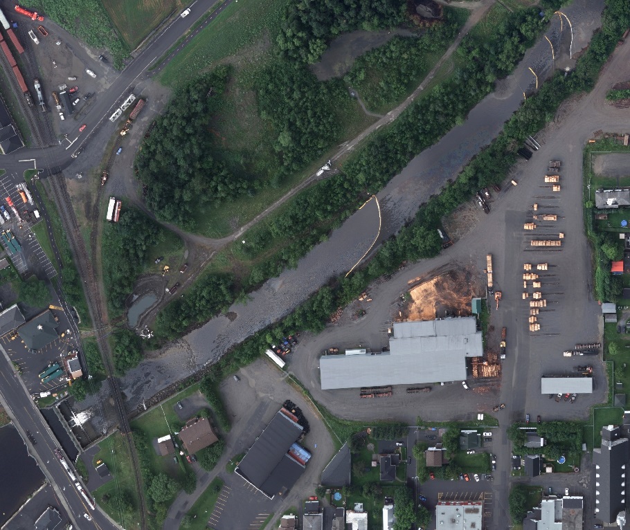

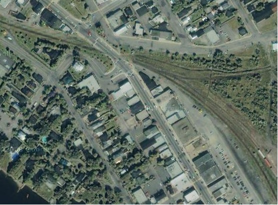
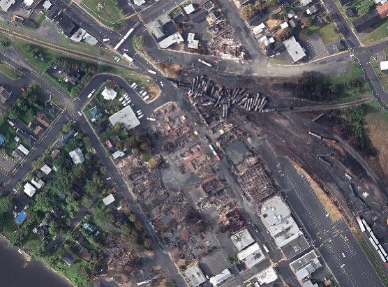
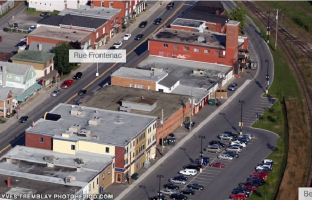
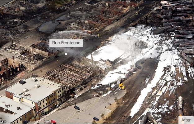
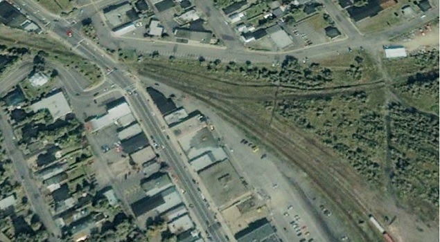
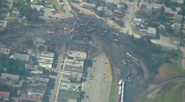
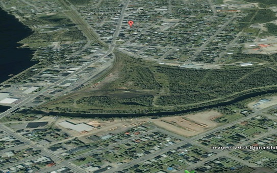
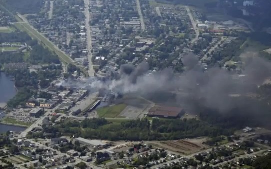
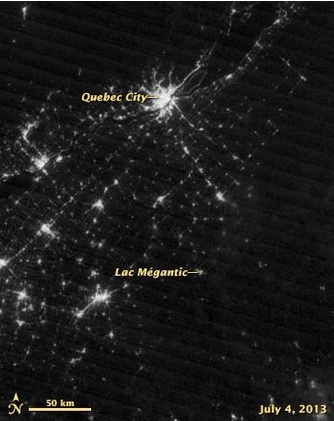
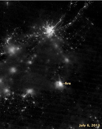
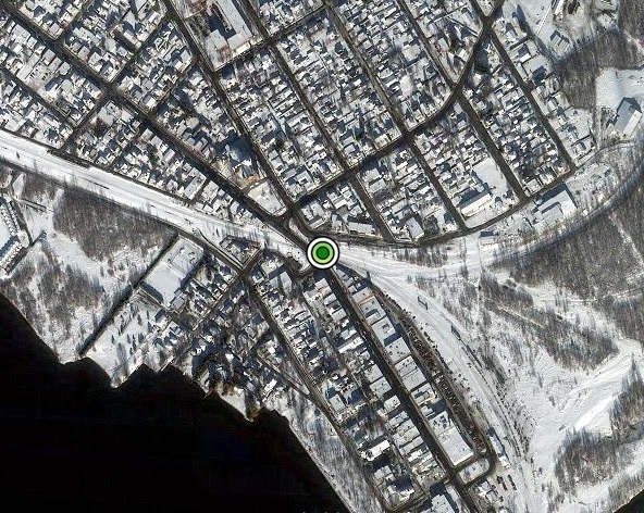
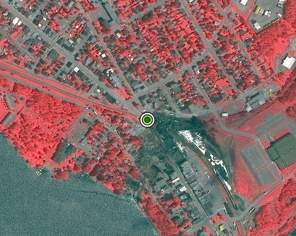
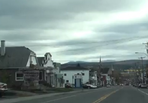
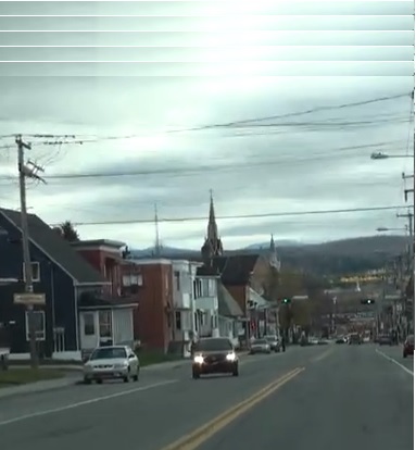
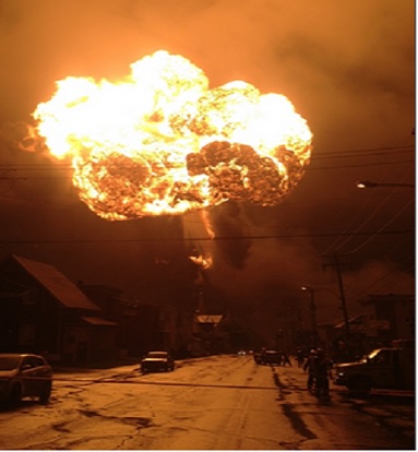
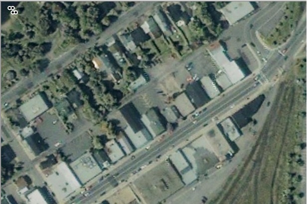
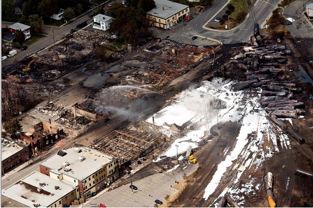
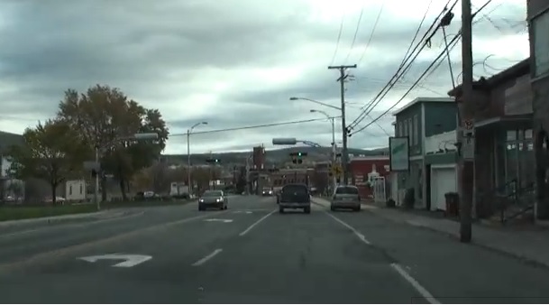
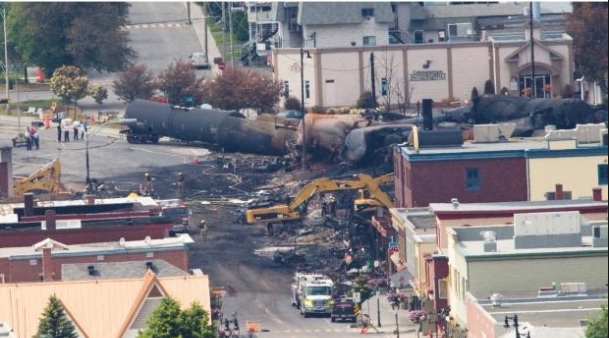
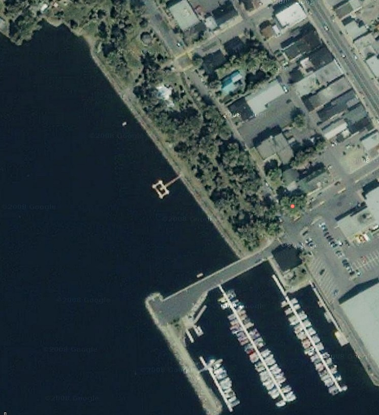
Use these interactive images to see different parts of Lac Megantic before and after the damage caused by the July 6 Train Runaway.
Hover over each satellite image to view the before and after comparison.
Image sources:
Before : YVES TREMBLAY PHOTOHELICO.COM, ESRI CANADA, U.S. National Aeronautics and Space Administration(Suomi NPP satellite), Digital Globe, You Tube Video: Fall 2010 Drive-Through Charming Lac Megantic, Quebec, Canada (https://www.youtube.com/watch?v=kRW0yEDxHlY)
After : Associated Press, ESRI CANADA, Digital Globe, U.S. National Aeronautics and Space Administration(Suomi NPP satellite), Quebec Government (http://geoegl.msp.gouv.qc.ca/golocmsp/?id=eba7a3b715)
Interactive images developed by: Ali Asgary, PhD. Associate Professor of Disaster and Emergency Management at York University
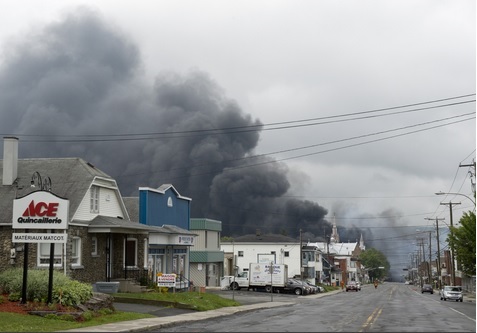
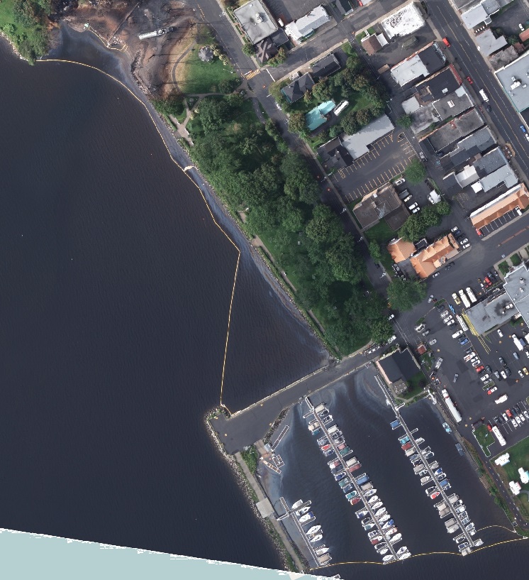
Oil slicks on the lack.