Case Study: July 2, 1997
Some nasty summer severe weather occurred on July 2, 1997, in southwestern Ontario and there was some speculation that lake breezes may have been involved. I decided to run MC2 for this day to assess the role of lake breezes. Indeed, the model predicts the development of 'high deformation' lake-breeze circulations. This type of lake breeze set-up (moderate S or SW surface winds with lake breezes and an approaching cold front) turns out to be rather important to summer severe weather forecasting and nowcasting in SW Ontario. Take a look for yourself!
On this day, tornadoes occurring in central and southeastern Michigan produced heavy damage and several fatalities. A line of supercell thunderstorms formed just ahead of an unseasonably strong cold front during the afternoon hours. As the line of storms, including a tornado, passed across the Detroit River to northeast of Windsor, the tornado lifted. Wall clouds were still reported as a supercell storm crossed Essex County. A few weak tornadoes are thought to have developed as storms moved into Kent County.
The conditions on this day have been modelled using MC2 on a 5 km
grid.
There is no convective parameterization scheme available for this grid
size so there are no precip data. The following are some results:
18 UTC - thunderstorms just beginning to pop up across
central
Michigan
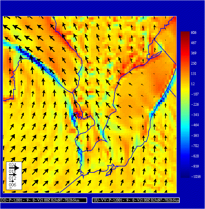
Surface divergence and 10m winds - lake breeze front segments off SW corners of lakes
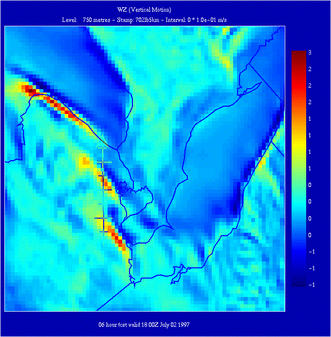
Vertical motion at 750 m with cross-section arrow
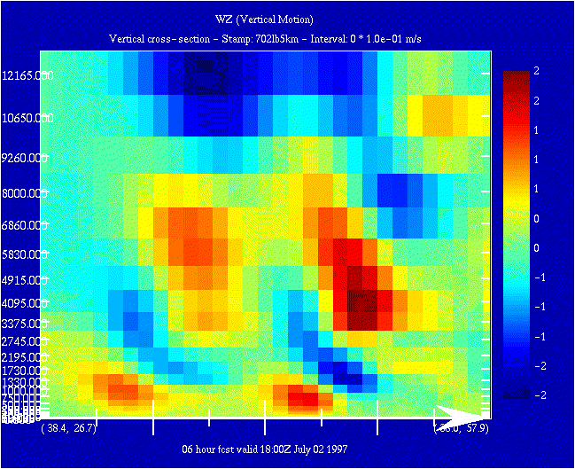
Cross-section through lake breeze fronts - take a look at those gravity waves!
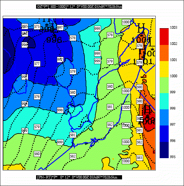
MSL Pressure and 1000-500 mb thickness
21 UTC - storms moving into the Detroit area
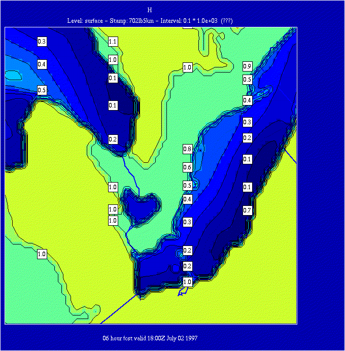
Surface divergence and 10 m winds - lake breeze front segments now joined along Michigan coast
Vertical motion at 1000 m with cross-section arrow - lake breeze front north of Lake Erie too
Cross-section through lake breeze fronts - gravity waves still hangin' in there!
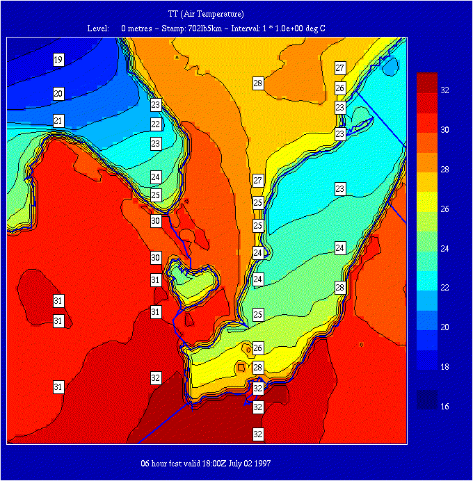
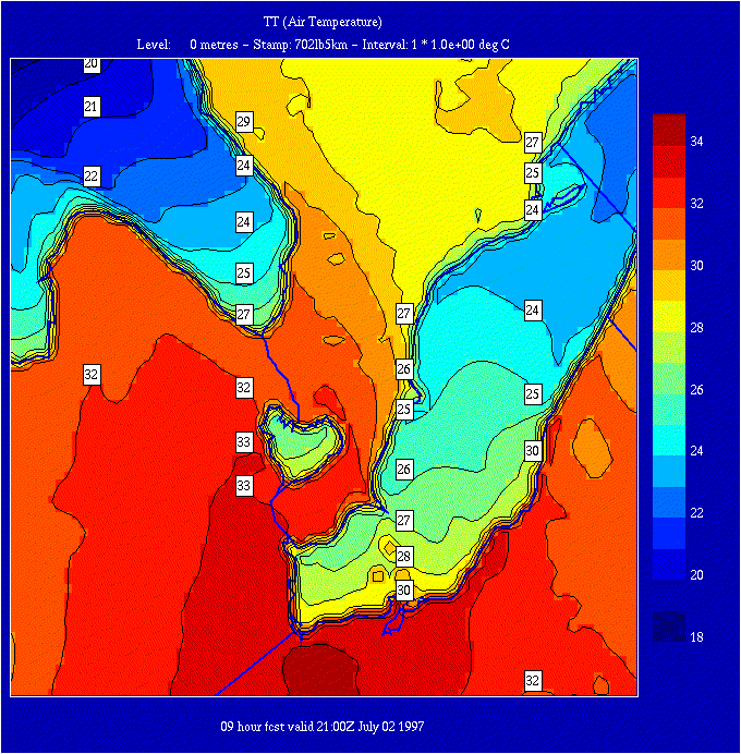
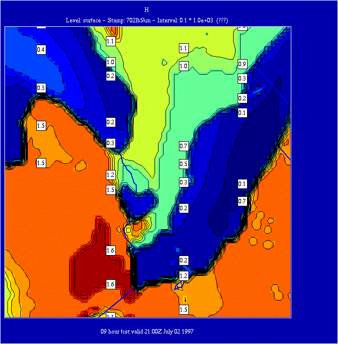
1.5 m temperatures - Detroit - Windsor in the hot zone
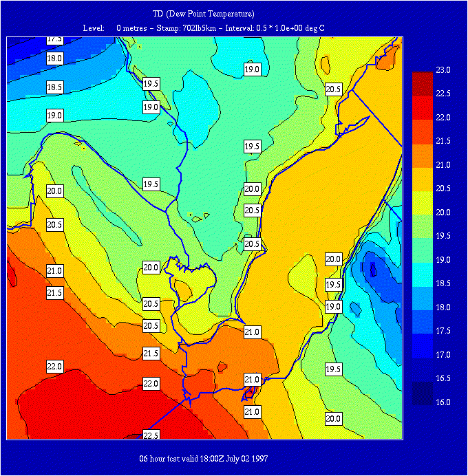
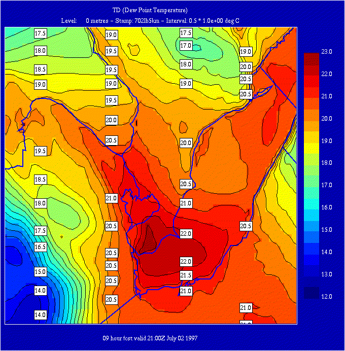
1.5 m dew point temperatures - lots of moisture too!
Boundary layer
heights - big difference downwind of the lakes in southwestern Ontario
00 UTC on July 3rd - line of storms has moved off
to
the east
MSL Pressure
and 1000-500 mb thickness - cold front moving through