MC2 modelling of meteorological conditions on this day showed that strong convergence lines developed by afternoon in the vicinity of the lakes (see the ELBOW article). Based on these data and observational data from this day, it appears that these convergence lines are in fact lake breeze fronts from highly-perturbed lake breeze circulations. However, the extent to which frictional or orographic factors influence these lines was not known.
The following are sensitivity tests using the MC2 model that have been conducted to assess the degree to which these convergence lines are related to lake breezes. In the first experiment, I add 10K, 13K then 20K to the climate values for lake surface temperature in July. With each increase, the difference between the 1.5 m air temperature over land and over water becomes less until, finally, it is less than 1C when 20K is added to the lake surface temperature. Since the driving force of the lake breeze is this land-lake air temperature difference, one would expect these convergence lines to weaken with as the temperature difference is decreased if the lines are indeed lake breeze fronts.
The second experiment involves 'paving over' one of the lakes, Lake St. Clair, to gauge the effect it has on the configuration of convergence lines that is produced by the model (and seen in observations). To remove the lake, geophysical fields were manually corrected so that grid point values varied smoothly from one shore to the other. So far, only Lake St. Clair has been removed since, due to its small size, the manual corrections to the geophysical fields are relatively simple. However, experiments involving the removal of the other lakes or combinations of lakes could also provide useful and interesting results.
For both experiments, the grid used is a 100x100 node mesh with 5 km
grid spacing. The domain is rotated so that north is toward the upper-left
corner of the figure. There are 28 vertical levels with half of those below
3000 m and a model lid at 24389 m. The time step used is 60 seconds and
the integration is started at 1200 UTC (Z) or 0700 LST. In the figures
shown below, the sponge zone (nominally 10 grid points) around the perimeter
of the domain has been removed.
Experiment 1 - Changing the lake surface temperature
To assess the impact of the lake surface temperature change, results from simulations using different lake surface temperatures will be compared for five fields: surface air temperature, surface dew point temperature, surface wind, surface divergence, and 500 m positive vertical motion. Each of these fields is valid for the 8th hour of integration at 2000 UTC (Z) or 1500 LST.
500 m positive vertical motion
The model output indicates that, as the lake surface temperature increases
and the land-lake air temperature difference decreases, the convergence
lines weaken and eventually disappear. This suggests that frictional and
orographic effects have a negligible contribution to the development of
the convergence lines and that the lines are indeed the result of land-lake
temperatures differences, and thus lake breezes. These lake breezes, however,
are 'highly perturbed' by the synoptic wind and thus have some characteristics
not normally associated with 'classic' lake breezes such as: the presence
of fronts mainly on the shore parallel to the synoptic wind, subtle changes
in surface wind speed and direction, temperature and moisture at the convergence
zone, and fronts that have been stretched inland from the lake and, in
some cases, have joined or merged with other fronts. Further research on
'highly-perturbed' lake breezes, especially in the context of severe summer
weather, is currently being undertaken.
Experiment 2 - Removing Lake St. Clair
The configuration of convergence lines that develops on July 14, 1997 appears to depend highly on the shapes and locations of the three lakes in the region: Lake Huron, Lake St. Clair and Lake Erie. To gauge the impact of Lake St. Clair on this configuration, the lake was effectively 'paved over' by manually correcting the geophysical fields (albedo, land-sea mask, roughness, etc.). Grid point values over the lake were manually interpolated from values along the shoreline. Selected results from this MC2 simulation are compared to the baseline simulation below.
500 m positive vertical motion
Diagnostic boundary-layer height
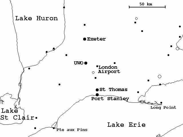
The above comparisons demonstrate that, while areas in the vicinity of the lake and approximately 100 km downwind (to the northeast) experience significant changes with the removal of Lake St. Clair, field values at inland locations east of a northwest-southeast line through London (see map) are nearly unchanged. However, when Lake St. Clair is present, the continuity of the convective regime from Michigan to Ontario is broken as can be seen in the boundary-layer height comparison. This break is likely responsible for the differences in storm characteristics over southeastern Michigan and over southwestern Ontario that was observed on this day. In southeastern Michigan, showers and thunderstorms developed along lake breeze fronts and had a northeast storm motion. In southwestern Ontario, an isolated, quasi-stationary multicell cluster developed where the Lake Huron and Lake Erie lake breeze fronts converged. No thunderstorms developed in the region downwind of Lake St. Clair.