Day 2 – Up to Minnesota??
2004 05 09
IA to SD
I woke up bright-eyed and
bushy-tailed at 8
am, though I could barely speak
now – my throat was a mess. Everyone else was still sleeping. So I took
the laptop and camcorder out to the veranda to catch some sun, eat a granola
bar, and capture some video. The WI-FI was also working so I did up an initial
forecast for the day.
It was a long time before a few
souls began to rise, then a data party ensued. Southwest Minnesota was clearly the “target du jour”. I never
thought we’d be heading to Minnesota, but you go where the storms are. We left at around 11:30 am with Chris and Dave and had some lunch before heading
north on I-35.
We stopped for data at the corner
of I-35 and I-90 for some data and met a pair of Italian chasers on a chase
holiday. The seductive powers of severe thunderstorms never cease to amaze me!
We found out via the Weather
Channel at the truck stop that there was a big supercell to our north heading
for Minneapolis. Though we could actually see it in the distance, we would
never be able to catch up with it, and we didn’t like the idea of
suburban chasing all that much. We decided to head west and hope for new
development to the SW of the big storm.
At 4:37 pm, we noted towering cumulus (known as tCu) developing and
breaking the cap to our northwest, which was southwest of the distant supercell
cluster. Our forecast was looking good! At 4:45 pm, we stopped and shot some video on our way north from I-90
toward Mankato. We were getting all kinds of calls on the cell phone
(George, Ron, Dave Patrick, Steve Mayne, Bob Berry – all chasers from
back in Ontario). The excitement was building.
Mark consults with Chris and Dave
Once we got west of Mankato, the towers that we had been following were now severe
warned storms and were located just to the north of us. We found a spot with a
great view off Highway 22 northwest of St. Peter and began to take pictures and
video. We were located between a very strong inflow region to our east and a
growing outflow region to our west. The inflow was around 40 mph and was
stirring up quite a bit of dust in the fields.
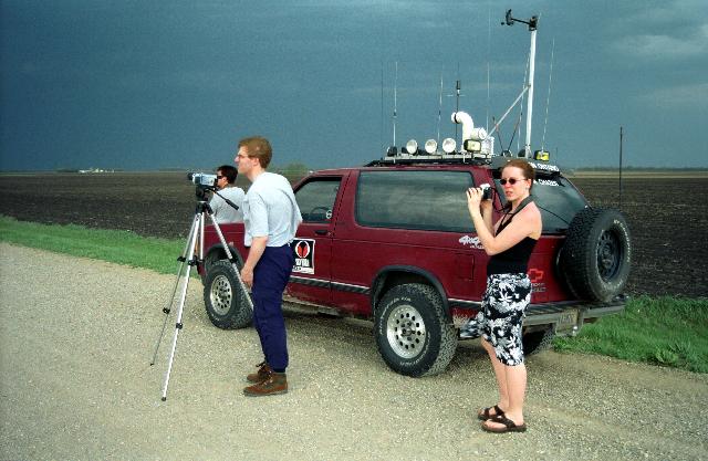
Photograph by Dave Lewison depicting the intrepid Southern
Ontario Chasers team.
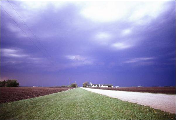
Photograph of the storm with outflow
boundary Cu approaching, looking roughly north.
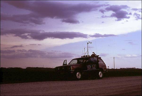
Photograph of Mark’s truck with
storm anvil and inflow Cu behind, facing roughly southeast.
The outflow boundary moved
steadily south and we could see periodic “dustbursts” along it
edge. These were dramatic – plumes of dust being lifted into the air and
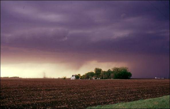
curled back around. At one point, Mark pointed out a small, dusty vortex to our
north at the interface between inflow and outflow, but it didn’t appear
to be connected to cloud base and there was no evidence of a wall cloud
overhead. This occurred so quickly that no one had time to get it on film.
Photograph of back edge of storm with
outflow “dustburst” to left of barn, facing roughly northwest.
Another view of the dust kicked up by microbursts
Shortly after, we realized that
the inflow winds had died right down, and the outflow boundary was likely to
pass any minute. Even knowing this, we all were surprised when the wind shifted
suddenly and the temperature plummeted over a period of seconds. Now that was a
gust front!
We decided to head a bit farther
south to get better pictures of the dustbursts that were still occurring, but
we didn’t end up seeing any again. We found another spot with a good view
and took some video and pictures of the line of convection that had formed to
our west. Not much was happening at this point, and no tornado warnings had
been issued, so we decided to head north and “play in the hail” a bit.
We never did find any.
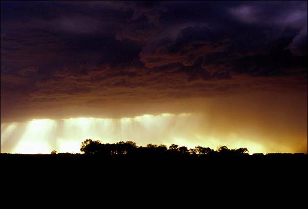
Photograph of dancing light beneath the
storm flank, facing roughly west.
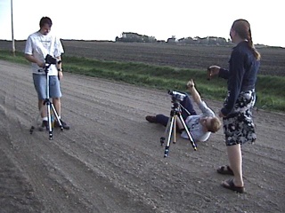
Mark going to great lengths to get the perfect shot
We called up Steve and Bob and
decided to head to Mankato for dinner. The town was pretty dead on a Sunday night
– only a few bars were open downtown. We had to choose the one with the
loudest music and the worst comedian. Soon, all that was forgotten as a potent
thunderstorm arrived, bringing hail, heavy rain and lots of lightning. We all
headed outside to see some hail – it was around 15 mm diameter max.
We knew we had a long drive west
so we left the bar soon after and jumped into our vehicles. Mark wanted me to
drive and I would have - except the truck wouldn’t start. Mark jumped in
and tried and tried, but no luck. Uh oh. Mark thought it might be the fuel
pump, but Steve came up with a ‘water in the gas’ theory. Sure
enough, Mark had forgotten the gas cap at a gas station in Iowa, and when the storm came, the rain got in behind the fuel
door. Now what? I suggested more gas to dilute the water, but Steve thought
that the water would still be separated and be laying at the bottom of the
tank. Hey…why not shake the truck to mix it up??
So, there we were on Main Street
Mankato, shaking the truck for all it was worth. And the truck
started. And died. But Mark got it started again after some more shaking. This
was progress. Then Mark decided he wanted to burn off the water by bombing up
and down Main Street Mankato with his lights off. I’m not sure how law
enforcement didn’t enter the picture at this point.
Soon, the truck was purring again
and we went on our way to Sioux
Falls, South Dakota – it was going to be a very late night. To top it
off, a deer bounded across the highway in front of Chris and Dave and somehow a
disaster was avoided. I swear some of the things that Chris calls hail dents
are hoof prints! We got into a Days Inn in Sioux Falls around 2 am.
ZZZZzzzzz….
|
All text and images by Dave Sills Copyright 2004
except photograph by Dave Lewison Copyright 2004.
Unauthorized use prohibited. All rights reserved.
|
<Day 1>
<Main Page> <Day 3>