Research Domain
Interested in becoming a graduate student in our lab?
I am recruiting motivated and skilled students for projects. I am specifically interested in candidates with strong computer programming experience.
Please read and fill this FORM before contacting me.
Shape and pattern analysis has been a central theme in our research; many of our developments connect to this area of significant contribution. While deliverables are primarily theoretical, the applied demonstration and intended audience includes landscape ecologists, foresters, and spatial analysts. Recent contributions include peer-reviewed papers, 2 book chapters, software packages, and numerous conference presentations. Our new and innovative method for characterizing planar shape (ShrinkShape) relies on an iterative inward step-wise shrinking of polygons until their extinction. We record the computed the area and perimeter of each polygon along with a count how many polygons and vertices remain after each iterative shrinking step. Graphs of these summary measures relative to the iteration step are used to characterize the compactness, complexity, size, and shape characteristics of each original individual polygon. The technique works equally well for comparing two identical shapes differing only by a rotation or scaling factor, making this approach scalable. This method provides a means for automatically comparing shape similarity quantitatively and provides considerably more information than the single-number patch-level metrics currently available. Implementation environments include ArcInfo and ArcMap and a recent complete overhaul to work in the R environment in conjunction with SAGA (a free and open GIS). Augmenting these tools is my work involving the comparison of spatial pattern at either landscape- or class-focus.
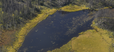
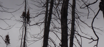
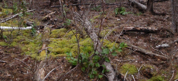
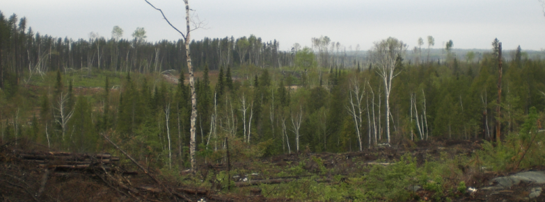
We seek to provide solutions for mapping dynamic and complex entities, specifically boreal wildfire disturbances and their associated residual vegetation patches. Our work scrutinizes the spatial patterns of unburned residual vegetation patches within burned boreal wildfire footprints with the goal of modelling at multiple spatial resolutions why these areas did not burn. This work dovetails with other research that focuses on the morphology of residual vegetation patches. We are currently writing a book that covers a broad spectrum of existing and emerging innovative methods for mapping forested landscapes, ranging from traditional mapping to the incorporation of seasonal contrasts, fuzzy memberships, complex objects, fuzzy boundaries, statistical abstractions, dynamic systems, and extensions to multiple dimensions.
Uncertainty and accuracy characterization and analysis have been a common thread linking all aspects of our research. Spearheading these contributions is a method that exploits an error matrix to obtain uncertainty information about configuration uncertainty between categorical maps. We also have a long record of providing theoretical and software tools for assessing class-focused landscape pattern metric variability and in building a framework for comparing categorical map patterns in a statistically defensible manner. Our aim is to provide our tools to everyone via the free and open source R environment on the Comprehensive R Archive Network (CRAN).
Primarily spurred by graduate projects, we have produced great advances in classifying tree genera from LiDAR point clouds. We have developed a novel ensemble classifier that uses combinations of metrics extracted from branching geometries mined from LiDAR data in conjunction with statistical metrics computed from vertical density profiles of point clouds.
Support our research: ![]()