Peer-Reviewed Journal Papers
Remmel, T.K., M. Ouellette, and W.J. Wu. 2023. A boreal wildfire and harvesting database with ensemble confidence attributes for Ontario (1972-2021+). International Journal of Applied Earth Observation and Geoinformation 117:103199. [DOI: 10.1016/j.jag.2023.103199]
Malik, K., C. Roberston, S.A. Roberts, T.K. Remmel, and J.A. Long. 2022. Computer vision models for comparing spatial patterns: understanding spatial scale. International Journal of Geographical Information Science. [DOI: 10.1080/13658816.2022.2103562]
Remmel, T.K. 2022. Extending morphological pattern analysis to 3D voxels. Landscape Ecology 37(2):373-380. [DOI: 10.1007/s10980-021-01384-7]
Horn, L., T.K. Remmel, and B.J.M. Stutchbury. 2021. Weak evidence of carry-over effects of overwinter climate and habitat productivity on spring passage of migratory songbirds at a northern stopover site in Ontario. Ornithological Applications 123:1-16. [DOI: 10.1093/ornithapp/daub012]
Remmel, T.K. and H. Moghaddam. 2020. Assessing morphological change in Canadian boreal forests. International Journal of Geoinformatics 16(3):49-59.
Remmel, T.K. 2020. Distributions of hyper-local configuration elements to characterize, compare, and assess landscape-level spatial patterns. Entropy 22(4):420. [DOI: 10.3390/e22040420]
Remmel, T.K. 2018. An incremental and philosophically different approach to measuring raster patch porosity. Sustainability 10:3413. [DOI:10.3390/su10103413]
Mahaney, W.C., P. Somelar, A. West, R. Dirszowsky, C.C.R. Allen, T.K. Remmel, and P. Tricart. 2017. Reconnaissance of the Hannibalic route in the Upper Po Vally, Italy: correlation with biostratigraphic historical archaeological evidence in the Upper Guil Valley of France. Archaeometry. (Online First)
Araya, Y.H., T.K. Remmel, and A.H. Perera. 2016. Spatially explicit prediction of residual vegetation patch occurrence within boreal wildfires. International Journal of Geoinformatics 12(3):1-15.
Ko, C., G. Sohn, T.K. Remmel, and J.R. Miller. 2016. Maximizing the diversity of ensemble Random Forests for tree genera classification using high density LiDAR data. Remote Sensing 8(8):646. [DOI: 10.3390/rs8080646]
Araya, Y.H., T.K. Remmel, and A.H. Perera. 2016. What governs the presence of residual vegetation in boreal wildfires? Journal of Geographical Systems 18(2):159-181. [DOI: 10.1007/s10109-016-0227-9]
Araya, Y., T.K Remmel, and A.H. Perera. 2015. Residual vegetation patches within natural boreal wildfires: characterizing by pattern metrics, land cover expectations, and proximity to firebreak features. Geomatica 69(4):327-338.
Remmel, T.K. 2015. ShrinkShape2: a FOSS toolbox for computing rotation-invariant shape spectra for characterizing and comparing polygons. The Canadian Geographer 59(4):532-547.
Ko, C., G. Sohn, T.K. Remmel and J.R. Miller. 2014. Hybrid ensemble classification of tree genera using airborne LiDAR data. Remote Sensing 6:11225-11243.[DOI: 10.3390/rs61111225]
Remmel, T.K. and T.A. Montour. 2014. Spatial bootstrapping of high spatial and temporal resolution thermal infrared imagery: a canopy wetness case study. International Journal of Geoinformatics 10(3):1-11.[Link]
Remmel, T.K. and M.-J. Fortin. 2013. Categorical class map patterns: characterization and comparison. Landscape Ecology 28(8):1587-1599. [DOI: 10.1007/s10980-013-9905-x]
Ko, C., G. Sohn, and T.K. Remmel. 2013. Tree genera classification with geometric features from high-density airborne LiDAR. Canadian Journal of Remote Sensing 39(S1):S1-S13. [e-First]
Remmel, T.K. and S.W. Mitchell. 2013. Importance of accurate visibility parameterization during atmospheric correction: impact on boreal forest classification. International Journal of Remote Sensing 34(14):5213-5227.
Ko, C., T.K. Remmel, and G. Sohn. 2012. Mapping tree genera using discrete LiDAR and geometric tree metrics. BOSQUE 33(3):313-319.
Lam, D.K., T.K. Remmel, and T. Drezner. 2011. Tracking desertification in California using remote sensing: a sand dune encroachment approach. Remote Sensing 3(1):1-13. [DOI: 10.3390/rs3010001]
Lam, D.K. and T.K. Remmel. 2010. Effect of spatial configuration on spectral signatures. Canadian Journal of Remote Sensing 36(1):48-54.
Remmel, T.K. and M-J. Fortin. 2010. Research in the spatial sciences: How are Canadian geographers contributing? The Canadian Geographer 54(1):4-14.
Remmel, T.K. and A.H. Perera. 2009. Mapping natural phenomena: boreal forest fires with non-discrete boundaries. Cartographica 44(4):274-288.
Remmel, T.K. 2009. Investigating global and local categorical map configuration comparisons based on coincidence matrices. Geographical Analysis 41(1):113-126. [Figures]
Remmel, T.K., K.W. Todd, and J. Buttle. 2008. A comparison of existing surficial hydrological layers in a low-relief forested Ontario landscape with those derived from a LiDAR DEM. Forestry Chronicle 84(6):850-865.
Buliung, R.N., M.J. Roorda, and T.K. Remmel. 2008. Exploring spatial variety in patterns of activity-travel behaviour: initial results from the Toronto Travel Activity Panel Survey (TTAPS). Transportation 36(6):697-722. [DOI: 10.1007/s11116-008-9178-4]
Buliung, R.N. and T.K. Remmel. 2008. Open source, spatial analysis, and activity-travel behaviour research: capabilities of the aspace package. Journal of Geographical Systems 10(2):191-215. [DOI: 10.1007/s10109-008-0063-7]
Mitchell, S.W., T.K. Remmel, F. Csillag, and M. Wulder. 2008. Distance to second cluster as a measure of classification confidence. Remote Sensing of Environment 112(5):2615-2626. [DOI: 10.1016/j.rse.2007.12.006]
Csillag, F., S. Kabos, and T.K. Remmel. 2008 (On-line in 2007). A spatial clustering perspective on autocorrelation and regionalization. Environmental and Ecological Statistics 15(4):385-401. [DOI: 10.1007/s10651-007-0068-2]
Wulder, M.A., J.C. White, J.E. Luther, G. Strickland, T.K. Remmel, and S.W. Mitchell. 2006. Use of vector polygons for the accuracy assessment of pixel-based land cover maps. Canadian Journal of Remote Sensing 32(3):268-279.
Remmel, T.K. and F. Csillag. 2006. Mutual information spectra for comparing categorical maps. International Journal of Remote Sensing 27(7):1425-1452.
Csillag, F., S. Kabos, and T.K. Remmel. 2006. Confidence in coincidence. International Journal of Remote Sensing 27(6):1269-1276.
Remmel, T.K., F. Csillag, S.W. Mitchell, and M. Wulder. 2005. Integration of remotely sensed and forest inventory data for national monitoring: Canadian status assessment and research issues. Forest Ecology and Management 207(3):405-428.
Remmel, T.K. and F. Csillag. 2003. When are two landscape pattern indices significantly different? Journal of Geographical Systems 5(4):331-351.![]()
Fortin, M-J., B. Boots, F. Csillag, and T.K. Remmel. 2003. On the role of spatial stochastic models in understanding landscape indices in ecology. Oikos 102:203-212.
Remmel, T.K. and A.H. Perera. 2002. Accuracy of discontinuous surfaces: a case study of boreal forest fires. International Journal of Geographical Information Science 16(3):289-300.
Remmel, T.K. and A.H. Perera. 2001. Fire mapping in a northern boreal forest: assessing AVHRR/NDVI methods of change detection. Forest Ecology and Management 152(1-3):119-129.
Guest Editorships
Remmel, T.K.. 2018. Special issue "Advances and applications in measuring, representing, and comparing spatial landscape patterns". Sustainability. [Link]
Edited Books
Remmel, T.K. and A.H. Perera (eds.). 2017. Mapping forest landscape patterns. New York: Springer. 326 p.
Peer-Reviewed Book Chapters
Remmel, T.K. and S.W. Mitchell. 2021. Landscape pattern analysis. In Francis, R.A., J.D.A. Millington, G.L.W. Perry, and E.S. Minor (eds.). The Routledge handbook on landscape ecology. London: Taylor and Francis. 544 p.
Youdelis, M. D. Douhaibi, D. Holterman, K. Paudel, V. Prestion, T.K. Remmel, E. Lunstrum, and J. Mensah. 2021. Out of Bounds: The BHER bones of teaching geography across borders. pp. 115-131. In Giles, W. and L. Miller (eds.). Borderless higher education for refugees: lessons from the Dadaab refugee camps. London: Bloomsbury Publishing 225 p. [Jackie Kirk Outstanding Book Award]![]()
Remmel, T.K. and A.H. Perera. 2017. Mapping forest landscapes: overview and a primer. pp. 1-62. In Remmel, T.K. and A.H. Perera (eds.). Mapping forest landscape patterns. New York: Springer. 326 p.
Remmel, T.K. and A.H. Perera. 2017. Portraying wildfires in forest landscapes as discrete complex objects. pp. 105-145. In Remmel, T.K. and A.H. Perera (eds.). Mapping forest landscape patterns. New York: Springer. 326 p.
Ko, C. and T.K. Remmel. 2017. Airborne LiDAR applications in forest landscapes. pp. 147-185. In Remmel, T.K. and A.H. Perera (eds.). Mapping forest landscape patterns. New York: Springer. 326 p.
Perera, A.H. and T.K. Remmel. 2017. Epilogue: toward more efficient and effective applications of forest landscape maps. pp.305-320. In Remmel, T.K. and A.H. Perera (eds.). Mapping forest landscape patterns. New York: Springer. 326 p.
Remmel, T.K. and M.-J. Fortin. 2017. What constitutes a significant difference in landscape pattern? pp. 105-125. In Gergel, S.E. and M. Turner (eds.). Learning landscape ecology: a practical guide to concepts and techniques (2nd Edition). New York: Springer-Verlag. 347 p.
Remmel, T.K., C. Ko, and R.L. Bello. 2010. Characterizing and comparing GIS polygon shape complexity by iterative shrinking spectra. 41-52 p. In Devillers, R. and H. Goodchild (eds.). Spatial data quality: from processes to decisions. New York: CRC Press. 222 p.
Perera, A.H., T.K. Remmel, L. Buse, and M. Ouellette. 2009. An assessment of residual patches in boreal fires in relation to Ontario's policy directions for emulating natural forest disturbance. Forest Research Report 169. Queen's Printer for Ontario. 75 p.
Remmel, T.K. 2009. An introduction to the Algonquin Park ecosystem. 14-35 p. In Euler, D. and M. Wilton (eds.). Algonquin Park: the human impact. Espanola: Algonquin Eco Watch. 397 p.
Software
Remmel, T.K. and R.N. Buliung. 2023. aspace: a collection of functions for estimating centrographic statistics. Version 4.0.1 (as of 28 August 2023) The Comprehensive R Archive Network (CRAN). GPL-3 (Link).
Remmel, T.K. 2023. morph: 3D segmentation of voxels into morphologic classes. Version 1.1.0 (as of 14 February 2023) The Comprehensive R Archive Network (CRAN). GPL-3 (Link).
Remmel, T.K. 2023. ShapePattern: a toolbox for characterizing and comparing polygon shape. Version 3.0.1 (as of 22 August 2023) The Comprehensive R Archive Network (CRAN). GPL-3 (Link).
Remmel, T.K. 2020. PatternClass: a collection of functions for comparing class-focused pattern metrics. (Migrated to ShapePattern). Version 2.0.1 (Archived). The Comprehensive R Archive Network (CRAN). GPL-3 (Link).
Remmel, T.K. and S. Kabos. 2007. hdeco: a collection of functions for decomposing entropy along spatial hierarchical partitions for categorical map comparison. Version 0.4. (Archived). The Comprehensive R Archive Network (CRAN). GPL-3 (Link).
Multimedia
Remmel, T.K. 2023. Technical Bites (Playlist). Learn something in under a minute. PATTERN Lab TechBites. Public YouTube videos [30 Videos @ 0:59 minutes each]
Remmel, T.K. 2022. Training: Constructing a Histogram in Microsoft Excel. PATTERN Lab Workshops. Public YouTube video [14:09 minutes].
Remmel, T.K. 2022. Training: Performing an eMail Merge in Microsoft Word. PATTERN Lab Workshops. Public YouTube video [17:33 minutes].
Remmel, T.K. 2022. Training: R Workshop 01 - The basics. PATTERN Lab Workshops. YouTube demo video [1:21:22 minutes].
Remmel, T.K. 2022. Training: Adaptable calculations in Excel. PATTERN Lab Workshops. Public YouTube demo video [13:55 minutes].
Remmel, T.K. 2021. Training: Formatting and presenting tabular data. Remmel Geoinformatics Lab Workshops. YouTube demo video [14:57 minutes].
Remmel, R. and T.K. Remmel 2021. Documentary: World War II: The Baltic Countries and Escape from the Soviets. Public YouTube documentary [40:53 minutes].
Remmel, T.K. 2020. Downloading Sentinel Imagery Via Copernicus Open Access Hub. Remmel Geoinformatics Lab Workshops. YouTube demo video [9:25 minutes].
Remmel, T.K. 2020. Pivot! Engaging, Interesting, and Real. YU Experience Hub's Experiential Education Celebration Event (online; invited). York University, Toronto, ON, Canada. Public YouTube presentation video [9:58 minutes].
Remmel, T.K. 2020. Training: Cloud Replacement Across Scenes with PCI Geomatica Banff. PATTERN Lab Workshops. Public YouTube video [9:03 minutes].
Remmel, T.K. 2020. Training: Cloud Replacement Within a Scene with PCI Geomatica Banff. PATTERN Lab Workshops. Public YouTube video [6:42 minutes].
Remmel, T.K. 2020. Demo: The Jastrow Illusion. PATTERN Lab Workshops. Public YouTube video [2:13 minutes].
Remmel, T.K. 2020. Course Trailer: The Centrality of Geomatics in Our Lives. Public YouTube video [2:27 minutes].
Remmel, T.K. 2020. Course Trailer: GEOG 2340: Geoinformatics: Introduction. Public YouTube video [1:24 minutes].
Remmel, T.K. 2020. Course Trailder: GEOG 4440: Geoinformatics: Remote Sensing II. Public YouTube video [1:24 minutes].
Remmel, T.K. and J. Thienpont. 2020. Experiential Education: The Flume. Remmel Geoinformatics Lab Workshops. YouTube demo video [1:29 minutes].
Remmel, T.K. 2015. ADC Snap Maiden Flight. Remmel Geoinformatics Lab Workshops. YouTube demo video [1:00 minutes].
David, Y. and T.K. Remmel 2015. Tension Infiltrometer. Remmel Geoinformatics Lab Workshops. YouTube training video [7:27 minutes].
In Preparation
Mitchell, S.W. and T.K. Remmel. Comparing non-destructive and destructive methods of LAI retrieval.
Remmel, T.K. and A.H. Perera. Spatial complexity within large contiguous disturbances: a case study of boreal forest fires.
Kabos, S. and T.K. Remmel. Effective simultaneous estimation of categorical map composition and configuration.
Technical Reports
Ouellette, M., T.K. Remmel, and A.H. Perera. 2020. A spatial database of historical wildfire and timber harvest in the boreal Area of the Undertaking of Ontario: The methodological framework. Ontario Ministry of Natural Resources and Forestry, Science and Research Branch, Peterborough, ON. Science and Research Technical Report TR-37. 31 p + appendix.
Remmel, T.K., and K. Todd. 2006. LiDAR for hydrologic mapping. A sub-report of the LiDAR (Light Detection and Ranging) data for hydrologic mapping & digital elevation modeling project. Trent University. 50 p.
Csillag, F., T.K. Remmel, and S. Kabos. 2004. A spectrum of entropy-based approaches to characterize the differences between maps. GEOIDE '2 MAPS' virtual workshop. 24 p.
Remmel, T.K. 2004. HDECO: a spectrum of hierarchical map comparisons, a user’s guide. Technical Report, Dept. of Geography, University of Toronto. 12 p.
Remmel, T.K. and F. Csillag. 2004. Preparation of NFI spatial and attribute data for integration with EOSD: an example using B.C. forest inventory data. Technical Report CFS-04, Department of Geography, University of Toronto. 28 p.
Csillag, F., T.K. Remmel, S.W. Mitchell, and M. Wulder. (in prep.). Comparing categorical forest maps by information theoretical distance. Technical Report CFS-03, Department of Geography, University of Toronto. 49 p.
Csillag, F., S.W. Mitchell, and T.K. Remmel. 2003. Integration of the National Forest Inventory with EOSD in the description of Canada's forests. Technical Report CFS-02, Department of Geography, University of Toronto. 35 p.
Csillag, F., T.K. Remmel, and S.W. Mitchell. 2003. Use of EOSD satellite data to detect change in pattern using NFI photo plot areas as context. Technical Report CFS-01, Department of Geography, University of Toronto. 20 p.
Invited Contributions
Remmel, T.K. 2008. Geographers at work: the use of geographic information systems in the boreal forests. p. 30. In Strahler, A. and O.W. Archibold. Physical geography: science and systems of the human environment (4th ed. Canadian Version). Hoboken, NJ: John Wiley & Sons, Inc. 652 p.
Conferences
Remmel, T.K. and B. Kerr. 2023. Comparing new process-based landscape fragmentation metrics with existing pattern-based metrics. International Association for Landscape Ecology - World Congress, 9-15 July, Nairobi, Kenya.
Noltie, K., D. Chen, M. Ouellette, and T.K. Remmel. 2023. Optimal best pixel composite approach for forest road extraction. 44th Canadian Symposium on Remote Sensing, June 19-22. Yellowknife, NWT, Canada.
Wu, W. and T.K. Remmel. 2023. Overlapping Landsat scene classifications and focal context identify boreal disturbance mapping uncertainty. Canadian Association of Geographers (CAG) Annual Meeting, 3-12 May, Université du Québec à Montréal, Montréal, Québec, Canada.
Kerr, B. and T.K. Remmel. 2023. Comparing process- and pattern-based measures of landscape fragmentation. Canadian Association of Geographers (CAG) Annual Meeting, 3-12 May, Université du Québec à Montréal, Montréal, Québec, Canada.
Lynch, P. and T.K. Remmel. 2023. Vegetation index sensitivities and structural biases. Canadian Association of Geographers (CAG) Annual Meeting, 3-12 May, Université du Québec à Montréal, Montréal, Québec, Canada.
Remmel, T.K. and B. Kerr. 2023. Comparing new process-based landscape fragmentation metrics with existing pattern-based metrics. International Association for Landscape Ecology - North America (IALE-NA), 19-23 March, Riverside, California, USA.
Lynch, P. and T.K. Remmel. 2023. Vegetation index sensitivities and structural biases. International Association for Landscape Ecology - North America (IALE-NA), 19-23 March, Riverside, California, USA.
Lynch, P., R. Bello and T.K. Remmel. 2023. NARR data analysis identifies climate change anomalies in Ontario's managed boreal forest. American Association of Geographers (AAG) Annual Meeting, 23-27 March, Denver, Colorado, USA.
Kerr, B. and T.K. Remmel. 2022. Process- versus pattern-based measures of landscape fragmentation. Canadian Association of Geographers (CAG) Annual Meeting (Online), 30 May - 3 June, University-X, Toronto, Ontario, Canada.
Wu, W. and T.K. Remmel. 2022. Quantifying orthogonal contextual data with tree and random forest classifiers to identify boreal disturbance mapping uncertainty. Canadian Association of Geographers (CAG) Annual Meeting (Online), 30 May - 3 June, University-X, Toronto, Ontario, Canada.
Remmel, T.K. 2022. Concepts and tools for extending morphological pattern segmentation from 2D pixels to 3D voxels. Canadian Association of Geographers (CAG) Annual Meeting (Online), 30 May - 3 June, University-X, Toronto, Ontario, Canada.
Lynch, P.J. and T.K. Remmel. 2022. Comparing VIIR-, NBR-, and NDVI-based post-fire regeneration assessments in Okanagan, British Columbia. Canadian Association of Geographers (CAG) Annual Meeting (Online), 30 May - 3 June, University-X, Toronto, Ontario, Canada.
Remmel, T.K. 2022. Morphological pattern segmentation for 3D voxel data. IALE-North America 2022 Annual Meeting (Online). 27-31 March 2022, Riverside, California, USA.
Lynch, P.J., R. Bello, and T.K. Remmel. 2021. NARR data analysis identifies climate change anomalies in Ontario's managed boreal forest. Canadian Association of Geographers (CAG) Annual Meeting (Online), 7-11 June, Prince George, British Columbia, Canada.
Wu, W., T.K. Remmel, and M. Ouellette. 2021. Exploiting overlapping Landsat scene classifications and focal context to identify boreal disturbance mapping uncertainty. Canadian Association of Geographers (CAG) Annual Meeting (Online), 7-11 June, Prince George, British Columbia, Canada.
Remmel, T.K. 2021. Hyper-local landscape configurations for inferring broad landscape structures. IALE-North America 2021 Annual Meeting (Online). 12-16 April 2021, Reno, Nevada, USA.
Lynch, P.J., R. Bello, and T.K. Remmel. 2021. NARR data analysis identifies climate change anomalies in Ontario's managed boreal forest. Research Day, Graduate Program in Geography (Online), 7-11 June, York University, Toronto, Ontario, Canada.
Chen, D., A. Harrison, K. Noltie, M. Ouellette, and T.K. Remmel. 2020. Identification of forest road construction year from historical remotely sensed data by integrating change detection and geometric connectivity rules. 41st Canadian Symposium on Remote Sensing: Landscapes of Change; Remote Sensing for a Sustainable Future. 13-17 July 2020, Yellowknife, Northwest Territories, Canada.
Harrison, A., K. Notlie, D. Chen, M. Ouellette, and T.K. Remmel. 2019. Identifying road construction year in Ontario's managed boreal forest through historical remotely sensed images using knowledge-based road connectivity and geometric rules. Sustainability: transdisciplinary theory, practice, and action conference, 16-18 October, Mississauga, Ontario, Canada.
Kerr, B. and T.K Remmel. 2019. Shape stability of features: assessing vertical profiles of UAV imagery. CAGONT 2019, University of Guelph 25-26 October 2019, Guelph, Ontario, Canada.
Remmel, T.K. and M. Ouellette. 2019. Five decades of boreal forest disturbance in Ontario, Canada. Special Session: Harmonized global and national assessments of forest spatial patterns and fragmentation. XXV IUFRO World Congress (Forest Research and Cooperation for Sustainable Development), 29 September - 5 October, Curitiba, Brazil.
Kerr, B. and T.K Remmel. 2019. Shape stability of features: assessing vertical profiles of UAV imagery. Poster presentation at the Dean's Award for Research Excellence (DARE) conference, Faculty of Liberal Arts and Professional Studies. Scott Library, York University. 2 October 2019.
Marosz-Wantuch, M., C. Haas, R. Bello, T.K. Remmel, G. Monette, and A.J. Casey. 2019. Impact of atmospheric forcing on the interannual variability of polynyas in landfast sea ice off Baffin Island, 1985-2017. 27th General Assembly of the International Union of Geodesy and Geophysics (IUGG), 8-18 July 2019, Montreal, Quebec, Canada.
Remmel, T.K., M. Ouellette, and A.H. Perera. 2018. A nearly 5-decade boreal disturbance dataset for Ontario: wildfire, harvest, and roads. 2018 International Geographical Union (IGU) Regional Conference - Canadian Association of Geographers (CAG) Annual Meeting, 6-10 August, Québec City, Québec, Canada.
Chase, M.I. and T.K. Remmel. 2017. Detecting geometric stream changes due to precipitation events: UAV monitoring: preliminary analysis. CAGONT 2017: Geographical perspectives: approaching a complex world. October 20-21, Queen's University, Kingston, Ontario, Canada.
Chase, M.I. and T.K. Remmel. 2017. Detecting geometric stream changes due to precipitation events: UAV monitoring. Canadian Association of Geographers Annual General Meeting, 29 May - 2 June, Toronto, Ontario, Canada.
Moghaddam, H. and T.K. Remmel. 2017. Spatial and temporal morphological change in boreal forests. Canadian Association of Geographers Annual General Meeting, 29 May - 2 June, Toronto, Ontario, Canada.
Chase, M. and T.K. Remmel. 2016. Change detection from Landsat: 2004 Indonesian tsunami. CAGNONT 2016, 28-29 October, University of Waterloo, Waterloo, Ontario, Canada.
Mitchell, S.W. and T.K. Remmel. 2016. Shape and resolution: quantifying feature morphology change due to coarsening spatial resolution using UAV-based images from vertical transects. GIScience 2016: 9th International Conference on Geographic Information Science, 27-30 September, Montreal, Québec, Canada. (Poster and short paper)
Remmel, T.K. and M. Chase. 2016. Term papers that are larger than the course itself. Teaching In Focus (TIF) Conference, 19-20 May, York University, Toronto, Canada. (Invited)
Chase, M. and T.K. Remmel. 2016. In the aftermath: detecting change from natural disasters using satellite imagery. 4th Annual Undergraduate Research Fair, 24 February, York University, Toronto, Canada. [First Prize for the Best Upper Year Projects - Dr. James Wu Prize]![]()
Remmel, T.K. 2016. Classifying boreal wildfires by clustering ShrinkShape2 spectra of internal unburned vegetation patches US-IALE 2016 Annual Meeting: Landscape Change, 3-7 April, Asheville, North Carolina, USA.
Perera, A.H., T.K. Remmel, and M.R. Ouellette. 2016. Assessing spatio-temporal patterns of extensive commercial forest harvest in northern Ontario, Canada. US-IALE 2016 Annual Meeting: Landscape Change, 3-7 April, Asheville, North Carolina, USA.
Singh, A. and T.K. Remmel. 2014. Scales of land cover morphology comprising residual vegetation within boreal wildfire footprints. CAGONT 2014: Critical human and physical geographies, October 24-25, York University, Toronto, Ontario, Canada.
Araya, Y. and T.K. Remmel. 2014. Designing a consistent and repeatable approach for characterizing the patterns of post-fire vegetation residual patches. CAGONT 2014: Critical human and physical geographies, October 24-25, York University, Toronto, Ontario, Canada.
Ko, C., T.K. Remmel, G. Sohn, and J.R. Miller. 2014. Tree genera classification using LiDAR data: quality of training samples. CAGONT 2014: Critical human and physical geographies, October 24-25, York University, Toronto, Ontario, Canada.
Ko, C., G. Sohn, T.K. Remmel, and J.R. Miller. 2014. Tree genera classification with unknown class using high density lidar data by ensemble classification models. IGARSS 2014/35th Canadian Symposium on Remote Sensing, July 13-18, Québec City, Québec, Canada.
David, Y., T.K. Remmel, and A. Robert. 2014. Quantifying runoff at the sub-watershed level with a physically based model: field measurements and the SWAT hydrological model. Canadian Association of Geographers Annual General Meeting, May 26-30, St. Catharines, Ontario, Canada.![]()
Araya, Y. and T.K. Remmel. 2014. An evaluation of the predictive performance of Random Forest model for residual patch existence in the Red Lake Fire, Ontario. Canadian Association of Geographers Annual General Meeting, May 26-30, St. Catharines, Ontario, Canada.
Singh, B. and T.K. Remmel. 2014. Effect of grain size on morphological pattern elements and land cover within boreal wildfire residual patches. Canadian Association of Geographers Annual General Meeting, May 26-30, St. Catharines, Ontario, Canada.
David, Y., T.K. Remmel, and A. Robert. 2014. Comparing influence of field measured parameters on physically based and empirical runoff algorithms within the SWAT hydrological model. TRIECA Conference, March 25-26, Toronto, Ontario, Canada.
Ko, C., T.K. Remmel, and G. Sohn. 2014. Tree genera classification using airborne LiDAR data by ensemble methods. Spatial Knowledge and Information Canada Conference, 7-9 February, Banff, Alberta, Canada.
Araya, Y. and T.K. Remmel. 2014. Spatially explicit model for predicting residual vegetation patch existence within boreal wildfires. Spatial Knowledge and Information Canada Conference, 7-9 February, Banff, Alberta, Canada.
David, Y., T.K. Remmel, and A. Robert. 2013. Using field measured parameters with the SWAT hydrological model to quantify runoff at the sub-watershed level. 2013 A.D. Latornell Conservation Symposium, November 20-22, Alliston, Ontario, Canada.
Ko, C., G. Sohn, T.K. Remmel, and J.R. Miller. 2013. Ensemble classification of tree genera from airborne LiDAR point clouds. Silvilaser: 13th international conference on LiDAR applications for assessing forest ecosystems, 9-11 October, Beijing, China.
David, Y., T.K. Remmel, and A. Robert. 2013. Using field measured parameters with the SWAT hydrological model to quantify runoff at the sub-watershed level. Canadian Association of Geographers Annual General Meeting, August 11-15, St. John's, Newfoundland, Canada.
Singh, A. and T.K. Remmel. 2013. Effect of grain size on morphological pattern elements within boreal wildfire residual patches. Canadian Association of Geographers Annual General Meeting, August 11-15, St. John's, Newfoundland, Canada.
Araya, Y. and T.K. Remmel. 2013. Spatially explicit probabilities of residual vegetation patch existence within boreal wildfires. Canadian Association of Geographers Annual General Meeting, August 11-15, St. John's, Newfoundland, Canada.
Remmel, T.K. and A.H. Perera. 2012. Mapping fuzzy boreal wildfire boundaries: strength, gradients, and cover types. IUFRO Landscape Ecology Conference, November 5-12, Concepción, Chile.
Ko, C., T.K. Remmel and G. Sohn. 2012. Mapping forest genera using discrete LiDAR and geometric tree metrics. IUFRO Landscape Ecology Conference, November 5-12, Concepción, Chile.
David, Y., T.K. Remmel, and A. Robert. 2012. Using field measured parameters with the SWAT hydrological model to quantify runoff at the sub-watershed level. CAGONT Annual Meeting, October 12-13, Toronto, Ontario, Canada.
Araya, Y. and T.K. Remmel. 2012. The effects of analytical scale on characterizing the spatial patterns of post-fire vegetation residual patches in boreal wildfires. CAGONT Annual Meeting, October 12-13, Toronto, Ontario, Canada.
Ko, C., G. Sohn, and T.K. Remmel. 2012. The impact of LiDAR point density on classifying tree genus: using geometric features and vertical profile features. SilviLaser 2012, September 16-19, Vancouver, British Columbia, Canada.
Ko, C., G. Sohn, and T.K. Remmel. 2012. A comparative study using geometric and vertical profile features derived from airborne LiDAR for classifying tree genera. The XXII Congress of the International Society of Photogrammetry and Remote Sensing, 25 August - September 1, Melbourne, Australia.
Ko, C., T.K. Remmel, and G. Sohn. 2012. Algorithm for processing a LiDAR point cloud to retrieve internal geometric tree crown structures. Canadian Association of Geographers Annual General Meeting, May 28 - June 2, Waterloo, Ontario, Canada.
Remmel, T.K. and M-J Fortin. 2012. What constitutes a significant difference in landscape class-level pattern? Canadian Association of Geographers Annual General Meeting, May 28 - June 2, Waterloo, Ontario, Canada.
Araya, Y. and T.K. Remmel. 2012. Characterizing the spatial patterns of post-fire vegetation residual patches in boreal wildfires: effects of analytical scale. Canadian Association of Geographers Annual General Meeting, May 28 - June 2, Waterloo, Ontario, Canada. ![]()
David, Y., T.D. Drezner, and T.K. Remmel. 2012. Effect of increased density of green roofs on low flows. Canadian Association of Geographers Annual General Meeting, May 28 - June 2, Waterloo, Ontario, Canada.
Ko, C., T.K. Remmel, and G. Sohn. 2011. Extracting geometric features from airborne LiDAR for tree species classification. Canadian Association of Geographers Annual General Meeting, May 31 - June 4, Calgary, Alberta, Canada. ![]()
Araya, Y.H. and T.K. Remmel. 2011. Estimating the parameters that govern the existence of residual vegetation patches within a fire disturbed boreal landscape. Canadian Association of Geographers Annual General Meeting, May 31 - June 4, Calgary, Alberta, Canada.
Mitchell, S.W. and T.K. Remmel. 2011. Impact of noise on land cover classifications: sensitivity analysis using simulated noise. Spatial Knowledge and Information (SKI) - Canada, March 4-6, Fernie, B.C., Canada.
Ko, C., G. Sohn, and T.K. Remmel. 2010. Experimental investigation of geometric features extracted from airborne LiDAR for tree species classification. Silvilaser: 10th International Conference on LiDAR Applications for Assessing Forest ecosystems, September 14-17, Freiburg, Germany.
Ko. C., T.K. Remmel, and G. Sohn. 2010. A statistical partitioning of vegetated airborne laser scanning data towards understory and canopy separation. Canadian Association of Geographers Annual General Meeting, June 1-5, Regina, Saskatchewan, Canada. ![]()
Lam, D.K. and T.K. Remmel. 2010. Monitoring moisture dynamics in a tree canopy using 4D GIS. Canadian Association of Geographers Annual General Meeting, June 1-5, Regina, Saskatchewan, Canada.
Araya, Y., G. Sohn, and T.K. Remmel. 2010. Remote sensing image classification using Random Forests classifier. Canadian Association of Geographers Annual General Meeting, June 1-5, Regina, Saskatchewan, Canada.
Remmel, T.K. and S.W. Mitchell. 2010. Effect of noise on land cover classification: a systematic analysis. Canadian Association of Geographers Annual General Meeting, June 1-5, Regina, Saskatchewan, Canada.
Ko, C., G. Sohn, and T.K. Remmel. 2010. Derivation of 3D geometric models of a single tree using high density airborne LiDAR data. Association of Ontario Land Surveyors: 118th Annual General Meeting, February 17-19, Huntsville, Ontario, Canada.
Remmel, T.K. and S.W. Mitchell. 2010. Random and spatially autocorrelated sensor noise effects on image classification. International Spatial Accuracy Research Association (ISARA) Ninth International Symposium on Spatial Accuracy Assessment in Natural Resources and Environmental Sciences, July 20-23, Leicester, UK.
Ko, C., G. Sohn, and T.K. Remmel. 2009. Classification for deciduous and coniferous trees using airborne LiDAR and internal structure reconstructions. Silvilaser 2009: 8th International Conference on LiDAR applications for Assessing Forest Ecosystems, October 14-16, College Station, Texas, USA.Ko, C., G. Sohn, and T.K. Remmel. 2009. A deciduous-coniferous classification and internal structure derivation using airborne LiDAR data. ISPRS Workshop: Laserscanning 2009, September 1-2, Paris, France.
Remmel, T.K., C. Ko, and R. Bello. 2009. Characterizing and comparing GIS polygon shape complexity by iterative shrinking spectra. 6th International Symposium on Spatial Data Quality, July 6-8, St. John's, Newfoundland, Canada.
Elliott, M., T.K. Remmel, and D. Bazley. 2009. An integrated investigation of vegetation gradients in the Mackenzie Valley, Northwest Territories, Canada. Canadian Association of Geographers Annual General Meeting, May 26-30, Ottawa, Ontario, Canada.
Ko, C., Remmel, T.K., and G. Sohn. 2009. A precise reconstruction of three-dimensional crown shape from airborne LiDAR point clouds. Canadian Association of Geographers Annual General Meeting, May 26-30, Ottawa, Ontario, Canada.
Lam, D.K., and T.K. Remmel. 2009. Green grass, yellow grass, does arrangement really matter? Comparative analysis of uniform composition and changing configuration on spectral signatures. Canadian Association of Geographers Annual General Meeting, May 26-30, Ottawa, Ontario, Canada.
Remmel, T.K.. 2009. Investigating global and local categorical map configuration comparisons based on coincidence matrices. Canadian Association of Geographers Annual General Meeting, May 26-30, Ottawa, Ontario, Canada.
Remmel, T.K. and A.H. Perera. 2008. Fuzzy approach for the assessment of the spatial geometry of boreal forest fires. IUFRO Landscape Ecology Working Group International Conference, September 16-18, Chengdu, Sichuan, P.R. China.
Mitchell, S.W., T.K. Remmel, and M. Wulder. 2008. How far is it?! The trials of measuring distance in spectral space, in attempts to provide a simple method to assess confidence in per-pixel class assignments. Canadian Association of Geographers Annual General Meeting, May 20-24, Québec City, Québec, Canada.
Remmel, T.K. and C. Ko. 2008. Characterizing and comparing GIS polygon shapes by iterative shrinking: a case study of forest fire residuals and arctic ponds. Canadian Association of Geographers Annual General Meeting, May 20-24, Québec City, Québec, Canada.
Weng, X. and T.K. Remmel. 2008. Image geometry and spatial resolution effects on forest biophysical variable estimation and regenerating stands. Canadian Association of Geographers Annual General Meeting, May 20-24, Québec City, Québec, Canada.
Dobrinescu, A. and T.K. Remmel. 2008. Nested multispectral-multiresolution measurements to characterize boreal clearcut boundaries and revegetation sites: a biophysical variable perspective. Canadian Association of Geographers Annual General Meeting, May 20-24, Québec City, Québec, Canada.
Buliung, R. and T.K. Remmel. 2008. Aspace: and open source toolkit for the centrographic home-range estimation of activity spaces. Transportation Research Board 2008 Annual Meeting, January 13-17, Washington, DC, USA.
Remmel, T.K. and A.H. Perera. 2007. Geospatial techniques for a multi-resolution assessment of post-fire boreal vegetation residual patterns. Geocomputation 2007, September 3-5, Maynooth, Ireland.
Perera, A.H. and T.K. Remmel. 2007. Post-fire tree residual aggregates in boreal forest landscapes: and assessment of spatial patterns by IKONOS imagery. International Association for Landscape Ecology World Congress, July 8-12, Wageningen, The Netherlands.
Remmel, T.K., A.H. Perera, and C. Eyjolfson. 2007. An assessment of post-fire boreal vegetation residual patterns measured at multiple spatial and thematic resolutions in Ontario. Canadian Association of Geographers Annual General Meeting, May 29-June 2, Saskatoon, Saskatchewan, Canada.
Buliung, R., and T.K. Remmel. 2006. Where have all the weekends gone? Comparative analysis of weekday and weekend activity spaces using data from the Toronto Travel Activity Panel Survey (TTAPS). 53rd Annual North American Meetings of the Regional Science Association International, November 16-18, Toronto, Ontario, Canada.
Remmel, T.K., S. Mitchell, and M. Wulder. 2006. Distance to second cluster as a measure of classification confidence. 4th International Conference on Geographic Information Science, September 20-23, Münster, Germany.
Mitchell, S., T.K. Remmel, and M. Wulder. 2006. Distance to second cluster as a measure of classification confidence. Free and Open Source Software for Geoinformatics, September 12-16, Lausanne, Switzerland.
Remmel, T.K., K.W. Todd, J. Buttle, G. Bruemmer, J. Pineau, P. Courville, K.W. Durst, J. Holland, R. Maher, M. Ryans, M. Partington, M. Woods, and A. Mutchmor. 2006. Lidar for hydrologic mapping. Winning Solutions 2006: FERIC Winning Solutions 2006, May 10-11, Sault Ste. Marie, Ontario, Canada.
Buliung, R., T.K. Remmel, and M. Roorda. 2006. Comparative analysis of weekday and weekend activity spaces. Annual Meeting of the Association of American Geographers, March 7-11, Chicago, Illinois, USA.
Remmel, T.K. and F. Csillag. 2005. Spectra of coincidences between spatial data sets: toward hierarchical inferential comparisons of categorical maps. GeoComputation International Conference, August 1-3, Ann Arbor, Michigan, USA.
Mitchell, S.W., T.K. Remmel, F. Csillag, and M. Wulder. 2005. Landscape pattern and per-pixel classification probabilities. GeoComputation International Conference, August 1-3, Ann Arbor, Michigan, USA.
Remmel, T.K. and F. Csillag. 2005. Spectra of coincidences between spatial data sets: toward hierarchical inferential comparisons of categorical maps. In Abstracts of the Canadian Association of Geographers (CAG) Annual Meeting, May 31-June 4, London, Ontario, Canada.
Boots, B., F. Csillag, and T.K. Remmel. 2005. Pattern metrics. Workshop at the US-IALE Conference, State University of New York, College of Environmental Science and Forestry, March 13, Syracuse, New York, USA.
Remmel, T.K., F. Csillag, S.W. Mitchell, and M. Wulder. 2004. Toward satellite-based large-area forest inventory: the impact of landscape pattern. In Proceedings of the Canadian Society for Landscape Ecology and Management (CSLEM) Conference, August 25-27, Waterloo, Ontario, Canada.
Mitchell, S.W., T.K. Remmel, F. Csillag, and M. Wulder. 2004. Can we infer landscape pattern from per-pixel classification?. In Abstracts of the Canadian Society for Landscape Ecology and Management (CSLEM) Conference, August 25-27, Waterloo, Ontario, Canada.
Remmel, T.K., F. Csillag, and B. Boots. 2004. Comparing maps as spatial processes. In Abstracts of the 5th Annual GEOIDE Scientific Conference (Poster), May 30 - June 1, Gatineau, Québec, Canada.
Remmel, T.K., F. Csillag, and S. Kabos. 2004. Using hierarchical entropy decomposition to compare the spatial patterns found in categorical digital maps. In Abstracts of the Canadian Association of Geographers (CAG) Annual Meeting, May 25-29, Moncton, New Brunswick, Canada.
Remmel, T.K., S.W. Mitchell, F. Csillag, M.A. Wulder, and M.D. Gillis. 2003. Integration of NFI and EOSD in the description of Canada's forests. 25th Canadian Remote Sensing Symposium, October 14-17, Montreal, Québec, Canada.
Csillag, F., T.K. Remmel, and S.W. Mitchell. 2003. Spatial analysis of disparate forest inventory data. Canadian Association of Geographers Meeting, May 27-31, Victoria, British Columbia, Canada.
Remmel, T.K., S.W. Mitchell, and F. Csillag. 2003. Pyramids and (heterogeneous) landscapes. Canadian Association of Geographers Meeting, May 27-31, Victoria, British Columbia, Canada.
Remmel, T.K., F. Csillag, and B. Boots. 2003. What is the difference between two maps? In Abstracts of the 4th Annual GEOIDE Scientific Conference (Poster), May 21-23, Victoria, British Columbia, Canada.
Fortin, M-J, B. Boots, F. Csillag, and T.K. Remmel. 2003. Spatial analysis of heterogeneous landscapes. 10th IES Cary Conference (Poster), April 29 - May 1, Millbrook, NY, USA.
Csillag, F., T.K. Remmel, and S. Kabos. 2003. Wavelets, boundaries and the spatial analysis of landscape pattern. In Proceedings of the US-International Association for Landscape Ecology (US-IALE) Conference, April 2-6, Banff, Alberta, Canada.
Mitchell, S.W., T.K. Remmel, and F. Csillag. 2003. Landscape partitioning: toward integrating local, hierarchical, and global statistics. In Proceedings of the US-International Association for Landscape Ecology (US-IALE) Conference (Poster), April 2-6, Banff, Alberta, Canada.
Remmel, T.K., F. Csillag, S.W. Mitchell, and B. Boots. 2002. Empirical distributions of landscape pattern indices as functions of classified image composition and spatial structure. In Proceedings of the Joint International Symposium on Geospatial Theory, Processing and Applications, July 8-12, Ottawa, Ontario, Canada. ![]()
Csillag, F., T.K. Remmel, and S.W. Mitchell. 2002. Toward a statistical framework for landscape pattern analysis. In Proceedings of the US-International Association for Landscape Ecology (US-IALE) Conference, April 23-27, Lincoln, Nebraska, USA.
Fortin, M-J, M. Philibert, T. Remmel, and F. Csillag. 2001. Sensitivity analysis of boundary detection on spatial features of heterogeneous landscape. The International Environmetrics Society (TIES), August 13-17, Portland, Oregon, USA.
Remmel, T.K. and F. Csillag. 2001. On the sensitivity of landscape pattern indices to composition and spatial autocorrelation. In Proceeding of the 3rd Annual GEOIDE Meeting (Poster), June 20-22, Fredricton, New Brunswick, Canada.
Fortin, M-J, M. Philibert, T. Remmel, and F. Csillag. 2001. Sensitivity analysis of boundary detection on spatial features of heterogeneous landscapes. In Proceedings of the US-International Association for Landscape Ecology (US-IALE) Conference, April 25-29, Tempe, Arizona, USA.
Remmel, T.K. and A.H. Perera. 2000. Accuracy of remotely-sensed fire mapping assessed with a GIS database. In Proceeding of GIS 2000 Conference, March 13-16, Toronto, Ontario, Canada. CD-ROM.
Theses
Remmel, T.K. 2005. Characterizing differences between categorical maps as functions of composition and configuration: a hierarchical spectra approach. Ph.D. Dissertation. University of Toronto, Toronto, Ontario, 221 p.
Remmel, T.K. 2000. Fire disturbance mapping in a northern boreal forest using AVHRR/NDVI imagery: Comparing techniques of change detection and substrate correction. M.Sc.F. thesis, Lakehead University, Thunder Bay, Ontario. 98 p.
Remmel, T.K. 1998. Quantifying the impact of varying road network densities on marten (Martes americana) harvest levels within selected traplines in Ontario. Honours B.E.S. thesis. University of Waterloo, Waterloo, Ontario. 63 p.
Invited Presentations
Remmel, T.K. 2016. GPS: What is it and how does it work? (In Estonian: Globaalne positsioneerimissusteem: miks ja kuidas?). Annual meeting of Estonian Guide Leaders (Translated from: Gaiderkogu koosolek). 30 April 2016, Toronto, Ontario, Canada.
Remmel, T.K. 2014. Remote sensing (Full day lecture in English with consecutive interpretation in Mandarin). Asian Business Management Program. 8 December, University of Toronto, Toronto, Ontario, Canada.
Remmel, T.K. 2014. FOSS for Geospatial Computing: R + SAGA -> RSAGA. Interdisciplinary Workshop on Geospatial Computing. 21 November, The Museum, Kitchener, Ontario, Canada.
Remmel, T.K. 2014. Learning from wildfires to better manage forest harvests (In Estonian: Kuidas metsatulekahjud oppetavad meil paremini metsandust labi viia). Forest University (Translated from: Kotkajarve Metsaulikool). 14 August, Port Sydney, Ontario, Canada.
Araya, Y.H. and T.K. Remmel. 2014. How well does my model work? Annual Geography Research Day, Department of Geography, York University, 28 March, Toronto, Ontario, Canada.
Araya, Y.H. and T.K. Remmel. 2014. Characterizing the spatial patterns and spatially explicit probabilities of post-fire vegetation residual patches in boreal wildfires. Physical Geography Brown Bag Presentation Series, York University. 20 March, Toronto, Ontario, Canada.
Remmel, T.K. 2014. Here a pattern, there a pattern, everywhere a pattern. Department of Geography Colloquium Series, York University. 7 January, Toronto, Ontario, Canada.
Remmel, T.K. 2013. 3000 years of innovation in the geosciences (In Estonian). 100th Anniversary of Rotalia: A Commemorative Ceremony. 26 October, Toronto, Ontario, Canada.
Remmel, T.K. 2013. Advanced uncertainty assessment methods. Guest lecture in GEOG 5010: Graduate Core Course. 25 November, Department of Geography and Program in Planning, University of Toronto, Toronto, Ontario, Canada.
Remmel, T.K. 2012. Measuring and comparing spatial patterns: digital geography. VEMU Research Seminar, January 11, Tartu College, Toronto, Ontario, Canada.
Remmel, T.K. 2010. Woo! Hoo! I was accepted... Now what?. Graduate Seminar, November 5, Department of Geography, University of Guelph, Guelph, Ontario, Canada.
Remmel, T.K., S.W. Mitchell, and M. Wulder. 2008. Assessing the accuracy of per-pixel class assignments in remote sensing: distance measurement in multi-spectral space. Csillag Seminar Series, November 26, Department of Geography, University of Toronto at Mississauga, Mississauga, Ontario, Canada.
Remmel, T.K. 2007. Geography awareness week and GIS day: reviewing 2006. Canadian Association of Geographers (CAG) Annual Meeting, May 30, University of Saskatchewan, Saskatoon, Saskatchewan, Canada.
Remmel, T.K. 2007. Geography awareness week and GIS day: planning for 2007. Canadian Association of Geographers (CAG) Annual Meeting, May 30, University of Saskatchewan, Saskatoon, Saskatchewan, Canada.
Remmel, T.K. 2006. LiDAR for hydrologic mapping: a summary of key project findings. Canadian Ecology Centre, June 19-20, Mattawa, Ontario, Canada.
Remmel, T.K. 2006. Map comparison by mutual information spectra. Founders Seminar Series, March 22, Department of Geography and Environmental Studies, Carleton University, Ottawa, Ontario, Canada.
Remmel, T.K. 2005. I can't see the difference! Can you see the difference?. Intersections Seminar Series, January 21, Department of Geography and Program in Planning, University of Toronto, Toronto, Ontario, Canada.
Remmel, T.K. 2005. Introduction to R and programming. A special presentation for the Landscape Ecology Lab, Department of Zoology. August 26, University of Toronto, Toronto, Ontario, Canada.
Remmel, T.K. 2005. Introduction to S+ (and R). Presentation and workshop for the GUESS Research Group. March 7, University of Toronto at Mississauga, Mississauga, Ontario, Canada.
Remmel, T.K., F. Csillag, and S.W. Mitchell. 2003. Accuracy assessment, shape, pattern, and entropy decomposition: Integration of NFI and EOSD in the description of Canada's forests. Presentation at the Physical Geography Research Day, University of Toronto, October 17, Toronto, Ontario, Canada.
Remmel, T.K., F. Csillag. 2002. Comparing spatial patterns among categorical images. Presentation at the Physical Geography Research Day, University of Toronto, October 18, Toronto, Ontario, Canada.
Remmel, T.K. 2002. Comparing spatial image patterns: composition and configuration. Presentation at the GIS and Remote Sensing Day for Physical Geographers, University of Toronto, May 21, Toronto, Ontario, Canada.
Remmel, T.K. and F. Csillag. 2002. When are two landscape indexes significantly different? Presentation to the GEOIDE ENV#4 research group. Pacific Forestry Centre, Victoria, B.C., Canada. January 24-27.
Remmel, T.K. 2000. Mapping spatial patterns of fire in Northern Ontario. Presentation to the Aviation Flood and Fire Management Branch, Ontario Ministry of Natural Resources, Roberta Bondar Place, Sault Ste. Marie, Ontario, Canada.
Remmel, T.K. 1998. Quantifying the impact of varying road network densities on marten (Martes americana) harvest levels within selected traplines in Ontario. Presentation at the Ontario Forest Research Institute, Sault Ste. Marie, Ontario, Canada.
Workshops
Remmel, T.K.. 2006. Advanced GIS and spatial analysis, April 3-7, Ontario Forest Research Institute, Sault Ste. Marie, Ontario, Canada.
Boots, B., T.K. Remmel, and F. Csillag. 2005. Pattern metrics: an appraisal of their role in characterizing landscapes, March 12-15, Syracuse, New York, USA.
Spatial Pattern
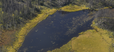
The core of our work relates to the measurement, quantification, and comparison of spatial pattern. We take a multiple scale view and explore applications within disturbed boreal environments.
Accuracy and Uncertainty
We develop software tools and statistical methods for improving the assessment of spatial accuracy and uncertainty, specifically for GIScience applications and categorical map comparisons.
FOSS Computing
We emphasize the use and development of Free and Open Source Software in the development and dissemination of our algorithms to simplify peer review and community adoption.
Contact: Traditional
- 137 Health, Nursing, and Environmental Studies Building (HNE)
Faculty of Environmental & Urban Change
York University
4700 Keele Street
Toronto, Ontario, M3J 1P3
Canada - Tel: +1-416-736-2100 ext. 22496
Lab: +1-416-736-2100 ext. 66187
Contact: Electronic
 Email: remmelt@yorku.ca
 Twitter: @TKRspatial
 Personal: www.yorku.ca/remmelt
 LinkedIn: Tarmo Remmel
 Skype: tarmoremmel
 ResearchGate: Tarmo Remmel
 Remmel Geoinformatics YouTube Channel
 TKRspatial Pixabay CC0 images
 https://orcid.org/0000-0001-6251-876X